4.1 Internal Roads
Overview
Lake Bennett Estate's internal road network provides access to all residential lots and infrastructure facilities. The road system is designed to accommodate residential traffic, service vehicles, and emergency access while maintaining the estate's rural character.
Road Specifications
Road Classification
- Primary Access Roads: Main arterial roads connecting to the public road network
- Service Roads: Access routes to infrastructure facilities and maintenance areas
Construction Standards
| Item | Detail |
|---|---|
| Surface Material | Sealed bitumen on primary roads, gravel on secondary and service roads |
| Road Width | 6–7 metres for primary roads |
| Drainage | Formed table drains and culverts for stormwater management |
| Load Rating | Designed for standard residential and service vehicle loads |
Road Layout
Primary Roads
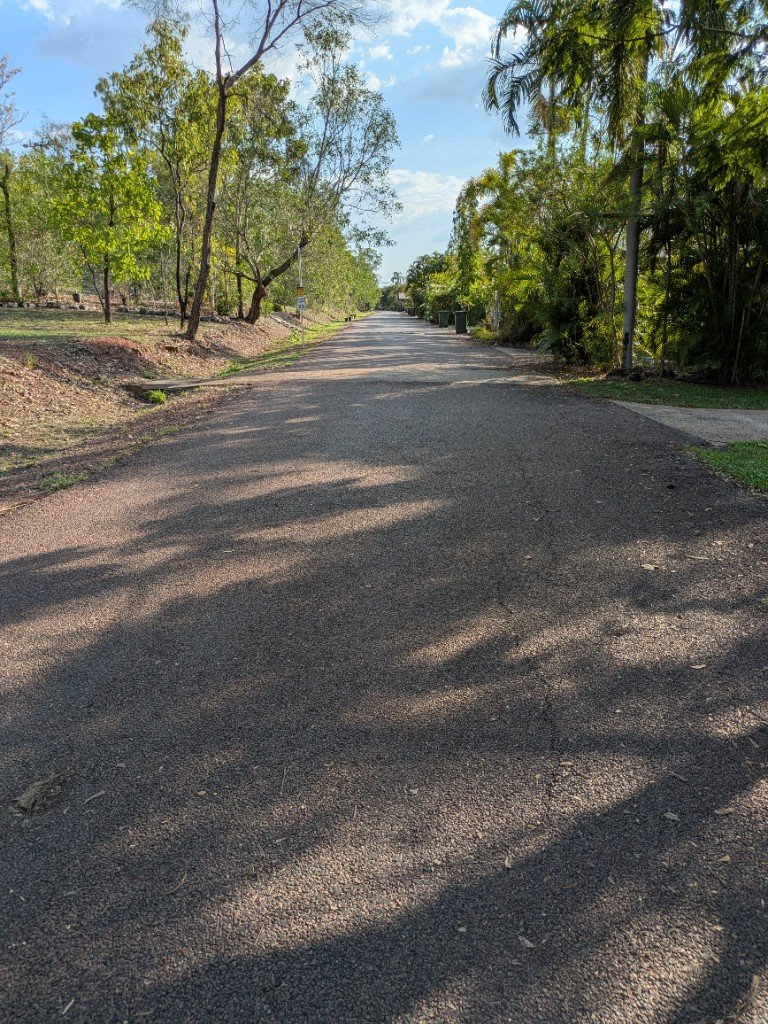
As part of the Lake Bennett Estate, the access roads are essential infrastructure maintained to a high standard. The estate features two primary bitumen roads:
| Road | Length |
|---|---|
| Eastside Road | Approximately 400 metres |
| Northshore Road | Approximately 250 metres |
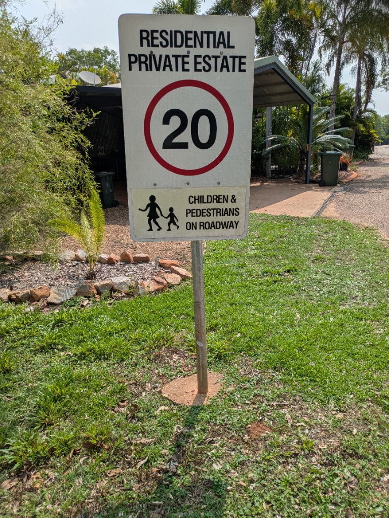
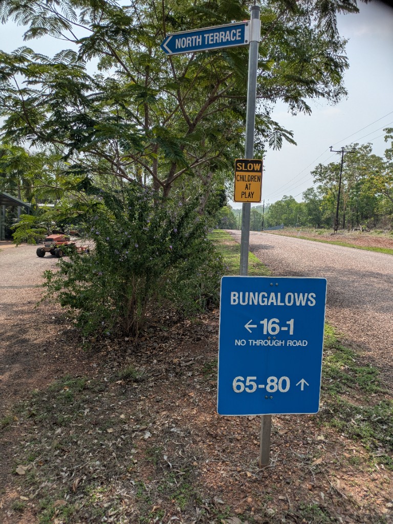
Northshore Road Entrance Signs
At the start of Northshore Road, a pole carries:
| Sign | Wording |
|---|---|
| Private estate / speed | RESIDENTIAL PRIVATE ESTATE — 20 km/h — CHILDREN & PEDESTRIANS ON ROADWAY |
| Street name | NORTH TERRACE (blue blade) |
| Children | SLOW CHILDREN AT PLAY (yellow) |
| Directions | BUNGALOWS — 16–1 (left arrow) NO THROUGH ROAD; 65–80 (up arrow) |
Both roads are surfaced with bitumen and require periodic maintenance to address wear and minor surface issues. For patching, we utilize EZ Street, a high-performance asphalt product supplied by Fulton Hogan. This product is chosen for its reliability and ease of application.
For further technical details, you can refer to the EZ Street product sheet. For any support or inquiries, Fulton Hogan can be contacted directly through their official website.
Traffic Management
Speed Limits
- Primary Roads: 20 km/h maximum
Traffic Control Devices
- Speed limit signage at entrances
- Reflective delineation posts where required
Maintenance Requirements
Regular Maintenance
| Surface | Requirement |
|---|---|
| Sealed Roads | Annual inspection and maintenance of surface integrity |
| Gravel Roads | Regular grading and re-sheeting as required |
| Drainage | Cleaning of table drains and culverts before each wet season |
Drainage
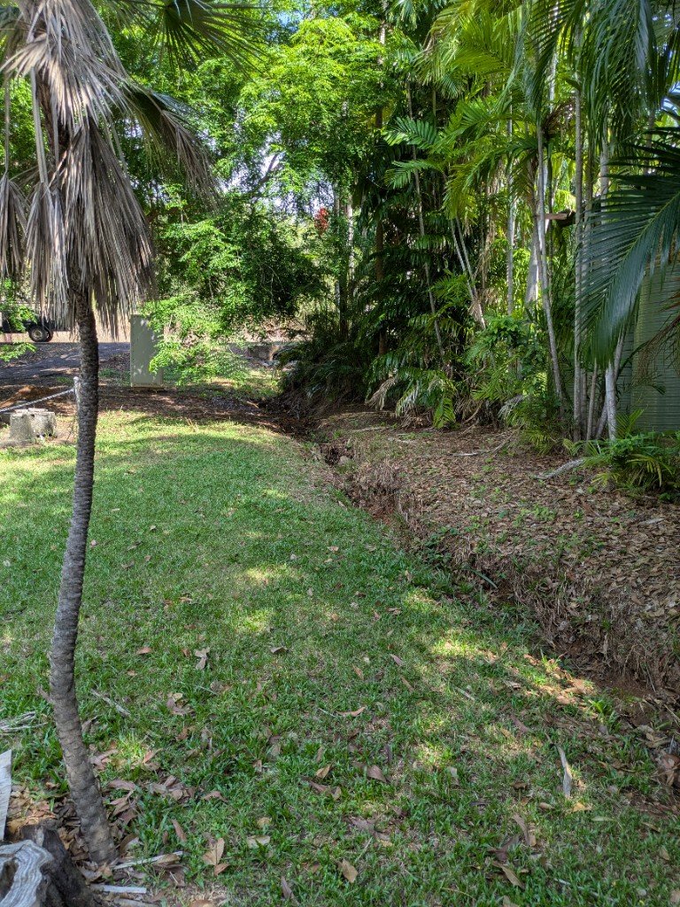
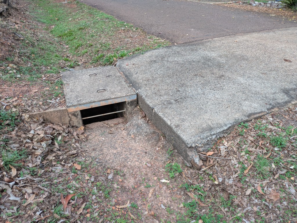
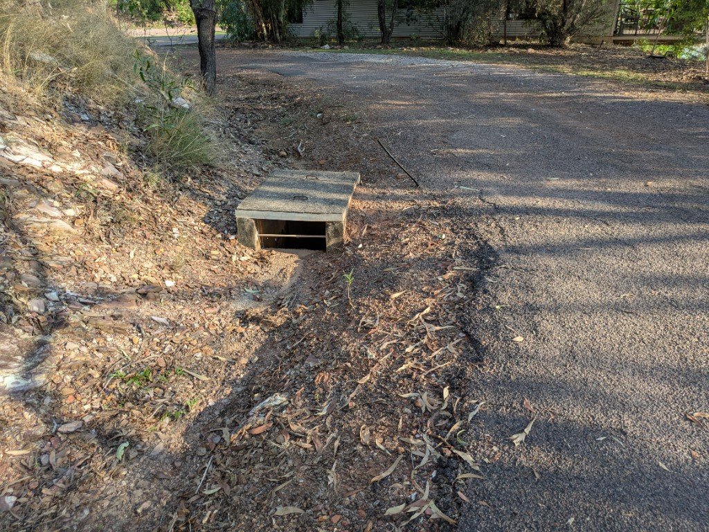
Formed table drains and swales carry stormwater clear of sealed and gravel roads. The Interactive Map lists named swale lines under Water Pipes → Swale Drains, including the west-side drain beside Pit 5 / SSP5, and stormwater pipe runs under Water Pipes → Storm (Storm 1–3).
Responsibility Matrix
| Party | Responsibility |
|---|---|
| Estate Management | Primary road maintenance |
| Property Owners | Driveway connections and immediate frontage areas |
| Council/Government | Public road interfaces and connections |
Safety Considerations
Design Features
- Appropriate sight distances
- Adequate width for two-way traffic and emergency vehicles
Hazard Management
- Regular inspection for potholes, erosion, and surface deterioration
- Vegetation management to maintain sight lines
- Seasonal maintenance scheduling around wet weather periods
Future Development
Planned Improvements
- Progressive sealing of high-traffic gravel roads
Version Control
| Version | Date | Description |
|---|---|---|
| 1.0 | 2025-10-06 | Initial Release |
| 1.1 | 2026-10-21 | Added Drainage section with west-side Pit 5 swale photo |
| 1.2 | 2026-10-21 | Added Eastside Road photo |
| 1.3 | 2026-10-21 | Added Storm 3 entry photo on Eastside Road |
| 1.4 | 2026-10-21 | Added Show on Map locate buttons |
| 1.5 | 2026-10-27 | Northshore Road entrance signs photo (NORTH TERRACE / bungalow directions) |
| 1.6 | 2026-10-27 | Northshore Road entrance — private estate / 20 km/h speed sign |
| 1.7 | 2026-11-01 | Storm 1 entry photo (concrete headwall / cover) |
Next Review Date: 2027-04-27